THE EYE OF THE SAHARA: THE MYSTERIOUS GIANT CIRCLE IN AFRICA
Explore Mauritania’s Richat Structure, the 40-kilometre Eye of the Sahara, and the geological evidence behind its concentric rings.
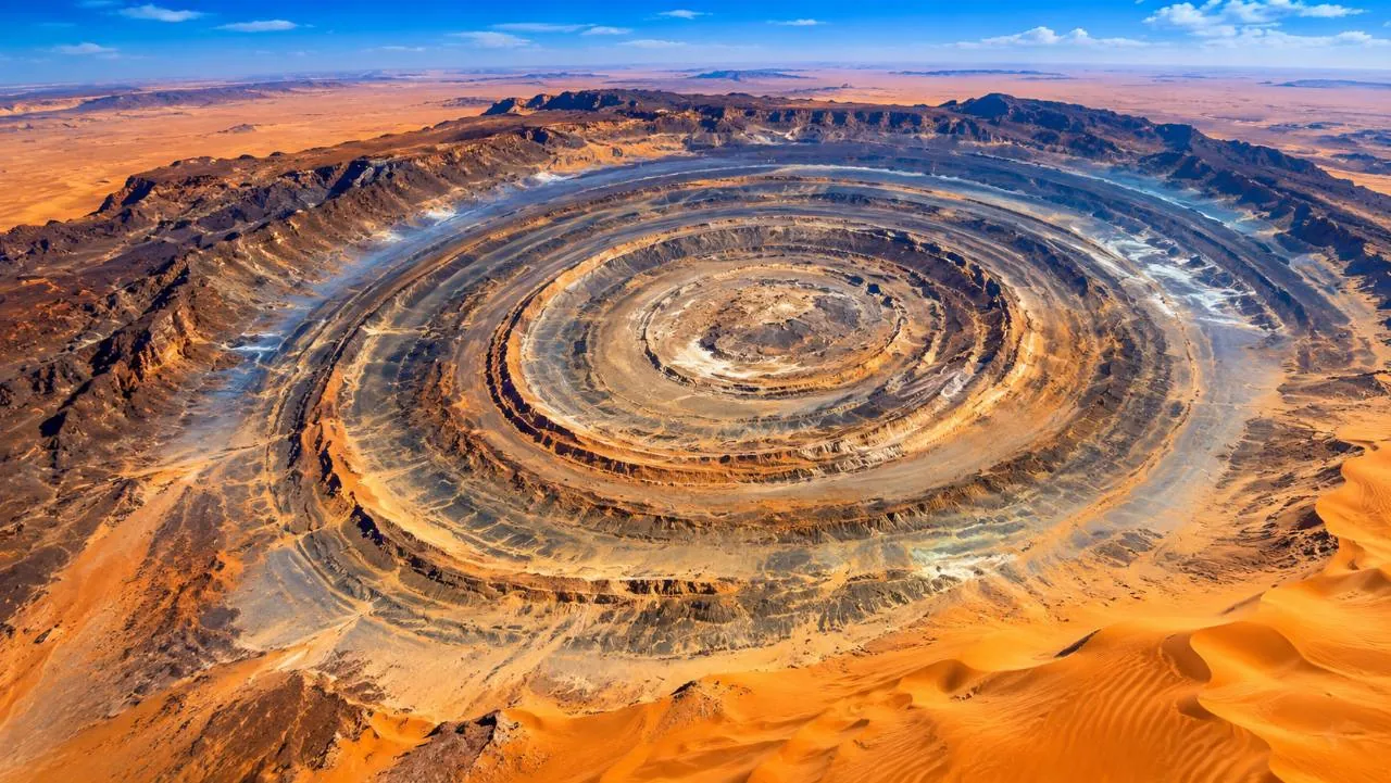
Conceptual depiction inspired by the Richat Structure, not a scientific aerial survey. Ring spacing, relief and colour should not be treated as measurements of the real site. Editorial image supplied for PRESDA. Original creator and reuse licence not provided.
Seen from above, the Richat Structure looks like a target drawn into the desert. Rings of rock interrupt the surrounding sands of Mauritania, giving the formation its popular name, the Eye of the Sahara. At roughly 40 kilometres across, it invites big explanations. The strongest one is geological: uplift exposed a dome of layered rock, and erosion made those layers visible as a striking concentric pattern. European Space Agency, Richat Structure
Where the Eye is, and why scale matters
NASA identifies the Richat Structure as an uplifted geologic dome, also called a domed anticline. Its astronaut imagery places the rings among extensive dune fields. From the ground, one sees pieces of ridges and outcrops rather than the entire target at once. The orbital view is therefore especially revealing, but visibility from space does not mean the formation was created by something from space. NASA Earth Observatory, The Eye of the Sahara
How erosion can draw rings
Imagine layers that were once more nearly horizontal and were later bent upward into a dome. Removing material from the top exposes different layers around its centre. Because rock types resist erosion differently, some remain as ridges while neighbouring material wears away more readily. NASA describes the resulting circular ridges as cuestas. This is differential erosion, not the work of an enormous circular cutting tool.
The US Geological Survey describes an eroded dome containing sedimentary and volcanic rock. It also notes that persistent northeasterly winds help keep much of it free of sand, exposing the rock layers. The pattern is thus a relationship between structure, materials and removal. A circular outline alone tells us very little about which process made it; the rocks and their arrangement provide the stronger evidence. US Geological Survey, Landsat view of the Richat Structure
Why the crater explanation lost ground
The circular shape initially encouraged an impact interpretation. Geological work instead supports doming and erosion. A 2005 Geology paper by Guillaume Matton, Michel Jébrak and James K. W. Lee proposed a model involving uplift, an alkaline igneous complex and hydrothermal dissolution and collapse within the centre. This is more complex than a simple bowl punched into the surface. It also shows why field evidence matters more than resemblance in an aerial image. Matton, Jébrak and Lee, Geology (2005), university research record
Mystery is an invitation to test explanations
Online stories sometimes present Richat as evidence of a lost civilisation or Atlantis. The geological sources cited here do not establish those claims. A ringed landscape is not itself evidence of streets, buildings or an ancient capital. An archaeological interpretation would require archaeological evidence in context, not a match between a dramatic picture and a remembered description. We can enjoy the visual mystery while keeping the explanation tied to what is documented.
The supplied hero is a conceptual editorial depiction, not a scientific aerial survey. Its ring spacing, relief and colour should not be used as measurements. Real satellite and astronaut observations remain the appropriate visual evidence for the structure. Richat is remarkable because geology can organise a landscape on this scale, not because every question about it must have an extraordinary non-geological answer.
Related reading: Remarkable natural phenomena.
FAQ
Frequently Asked Questions
Where is the Eye of the Sahara?
The Richat Structure is in Mauritania in northwestern Africa. Its concentric ridges extend across roughly 40 kilometres.
Is it a meteorite crater?
The accepted geological explanation is an uplifted dome shaped by erosion. Its circular outline alone does not demonstrate an impact.
Do the rings prove that it was Atlantis?
No. The geological sources cited do not establish a lost city. Archaeological claims require archaeological evidence in context.
PRESDA Dispatch
Stay Informed. Stay Aware.
A sharp briefing across AI, gaming, sport, business, world affairs, paparazzi, and lifestyle.