THE INDUS VALLEY: INSIDE ONE OF THE ANCIENT WORLD’S GREATEST CIVILIZATIONS
Inside Harappa, Mohenjo-daro, Dholavira and Rakhigarhi: urban engineering, trade, unread seals, ancient DNA and the evidence behind the Indus decline.
Follow a street through the ruins of Mohenjo-daro and the ancient city becomes legible in unexpected ways. Walls preserve the boundaries of houses; wells and drains reveal how water moved through everyday life. What is harder to recover is the voice of the people who built it. Their names, political titles and written accounts remain beyond our reach.
The Indus Valley Civilization, also called the Harappan civilization, was a Bronze Age urban society centred in present-day Pakistan and northwest India, extending into Gujarat. Its major urban phase is generally dated to about 2600–1900 BCE. Its achievement was not a single spectacular monument, but an interconnected landscape of cities, smaller settlements, farms and skilled production. UNESCO: Mohenjo-daro Kenoyer and Meadow: Harappa excavations and chronology
FROM FARMING VILLAGES TO URBAN SOUTH ASIA
Its roots reach into much earlier farming communities, including Mehrgarh in Balochistan from roughly 7000 BCE. These were precursors, not a seven-thousand-year-old version of the mature civilization. Over millennia, cultivation, herding, exchange and regional settlement traditions created the foundations on which larger towns developed. Harappa: regional origins
At Harappa, excavations distinguish an early sequence beginning around 3300 BCE, followed by the great urban phase around 2600 BCE and later transformations after about 1900 BCE. The familiar Early, Mature and Late Harappan labels organize this evidence; local sequences do not all start or finish on the same date. Archaeological periods are working frameworks, not recorded royal reigns. Kenoyer and Meadow: Harappa excavations and chronology
Approximate dates. Regional sequences differ. This is an ordered chronology, not a scale of equal durations.
c. 7000 BCE
Farming precursors
Mehrgarh belongs to the earlier farming background, not the mature civilization.
c. 3300–2600 BCE
Early Harappan
Regional settlements develop; Harappa’s early sequence begins around 3300 BCE.
c. 2600–1900 BCE
Mature Harappan
Large urban centres and shared material practices connect the region.
c. 1900–1300 BCE
Late Harappan
Urban contraction and changing regional traditions; populations continue.
Sources and dating: Harappa, Kenoyer & Meadow
PRESDA Data Graphics
HOW LARGE WAS THE INDUS WORLD?
Its settlements occupied a vast zone connecting the Indus basin, Punjab, the Ghaggar-Hakra region and Gujarat, with networks reaching beyond these areas. Scholars commonly describe an archaeological distribution on the order of a million square kilometres. That is a cultural footprint, not a surveyed border proving that one empire ruled every place within it. Mahadevan: political and social organization
More than 1,000 Harappan sites have been identified, according to UNESCO’s Dholavira assessment. Population figures are much less secure: published estimates range from roughly one to five million for the civilization. There was no surviving census. Reconstructions depend on settlement size, occupation density and assumptions about rural communities, so an exact population would imply more certainty than the evidence permits. UNESCO: Dholavira Irfan Habib: The Indus Civilization, population estimates
FOUR CITIES, DIFFERENT LANDSCAPES
Harappa, in Pakistan’s Punjab, gives the civilization its archaeological name. Excavation reveals changing town layouts, production areas, burials and inscribed objects across a long sequence. It was one major centre among several, not a securely identified capital from which all the others were governed. Kenoyer and Meadow: Harappa excavations and chronology
Mohenjo-daro, in Sindh, preserves the most recognizable urban image of the Indus world: brick-built neighbourhoods, streets and major public structures. UNESCO dates its foundation to the third millennium BCE. The elevated and lower sectors are archaeological realities, but labels such as “citadel” do not by themselves identify a king’s fortress. UNESCO: Mohenjo-daro
Dholavira, on Khadir island in Gujarat’s Kutch region, adapted to an arid environment with extensive stone construction and reservoirs. Its segmented urban layout and cemetery demonstrate both local distinctiveness and connections to the wider Harappan world. Water management was fundamental to its location, rather than an optional addition to city life. UNESCO: Dholavira
Rakhigarhi, in Haryana, is a major settlement at the eastern side of this landscape. Streets, craft activity and burials contribute to its importance. It also produced the individual studied in the 2019 ancient-DNA paper. Claims about which Indus city was “largest” require caution: excavated area, total mound extent and contemporaneously occupied area are different measurements. Haryana government: Rakhigarhi Shinde et al. (2019): Rakhigarhi genome, Cell
Selected centres, not every major settlement. Modern locations orient the reader; they are not ancient political boundaries.
Dholavira
Kutch, Gujarat, India
Stone construction and seasonal-water reservoirs
Archaeological sourcesPRESDA Data Graphics
THE ENGINEERING OF ORDINARY LIFE
The cities show deliberate planning, although no single plan describes every neighbourhood or settlement. Major streets, residential blocks, platforms and gateways organized movement and building. Domestic bathing areas and drains make public infrastructure visible inside private life. This was practical urban technology, maintained and rebuilt over generations, rather than a frozen master plan. UNESCO: Mohenjo-daro Harappa archaeological photographs: Mohenjo-daro
Bricks often followed a thickness-width-length ratio of 1:2:4. Kenoyer’s study also records variation in dimensions and proportions. Shared building conventions and standardized weights suggest coordination and reproducible skills across considerable distances. They do not prove identical rules everywhere, a modern bureaucracy or a single central authority. Kenoyer: Measuring the Harappan World
Wells, washing floors and drainage channels were connected in sophisticated ways, especially at Mohenjo-daro. Covered drains and access arrangements indicate that maintenance mattered. Calling this “modern sanitation” goes too far: surviving installations do not establish universal access, clean drinking water for everyone or the elimination of disease. The achievement is impressive without those claims. Harappa archaeological photographs: Mohenjo-daro
THE GREAT BATH AND THE PROBLEM OF PURPOSE
Mohenjo-daro’s Great Bath measures approximately 12 metres by 7 metres, with a maximum depth of about 2.4 metres. Carefully fitted bricks and bitumen helped make its basin watertight, and a drain controlled outflow. Its substantial construction is established. Communal or ritual bathing is a plausible interpretation; the ceremony, participants and theology are unknown. Harappa archaeological photographs: Mohenjo-daro
Dholavira presents another response to water scarcity: collecting and storing seasonal flows in reservoirs. These two cities warn against treating the civilization as a uniform riverbank society. Different landscapes required different arrangements, while shared technical knowledge helped people make large settlements workable. UNESCO: Dholavira
FARMS, FOOD AND HOUSEHOLDS
Urban life depended on farmers and herders outside the monumental centres. Archaeobotanical evidence shows regional combinations of wheat, barley, millets, pulses and rice, rather than a single crop package feeding the whole civilization. Summer and winter cultivation could diversify food supply. The distribution and dating of individual crops must be established site by site. Petrie and Bates (2017): diverse cropping strategies
Petrie and Bates argue that varied cropping practices offered ways to adapt to changing environments. Subsequent research likewise stresses different farming choices and outcomes. This matters for decline: a rainfall change could hurt one locality while another adjusted its crops or settlement pattern. Food resilience was uneven, not a civilization-wide switch that suddenly failed. Petrie and Bates (2017): diverse cropping strategies Bates (2023): farming choices, Antiquity
Household remains bring the scale back to people: pottery for preparation and storage, ornaments, tools and terracotta figures. Archaeologists reconstruct activities through the context in which objects were found. A figurine might have several uses; calling every small object a toy, idol or portrait would turn an interpretation into a fact. Sharri Clark: Embodying Indus Life
CRAFTS, MATERIALS AND CONNECTED MARKETS
Indus craftspeople worked stone, shell, copper alloys and clay, making beads, ornaments, tools and seals. Excavated workshops and unfinished objects reveal production processes more reliably than the imagined biographies of their makers. Dholavira’s finds include carnelian and other semi-precious materials, illustrating how local production depended on wider access to resources. UNESCO: Dholavira Kenoyer: Measuring the Harappan World
Small stone seals combine animal imagery with short sequences of signs. Bulls, elephants and the conventionally named “unicorn” appear in the material record. Seal impressions could identify or secure goods and transactions, but the precise meaning of particular designs is not established. A familiar motif is not a decoded name or the emblem of a known dynasty. Metropolitan Museum of Art: South Asia, seals and trade, pp. 59–60 Kenoyer (2020): development of the Indus script
TRADE BEYOND THE INDUS
Indus seals in Mesopotamia and western Asian seals at Indus sites document long-distance contacts. Exchange connected inland production with the Arabian Sea and Gulf, including the Oman peninsula. Mesopotamian references to Meluhha are commonly associated with the Indus region, although the surviving names cannot turn every proposed voyage into a documented itinerary. Metropolitan Museum of Art: South Asia, seals and trade, pp. 59–60 UNESCO: Dholavira
These connections were part of a broader network of raw materials and finished goods. Archaeological distribution can establish that something travelled; it may not identify whether a merchant, intermediary or migrating community carried it. Routes changed over time. The evidence supports a connected Bronze Age economy, not a complete map of a single trading company.
WHO GOVERNED CITIES WITHOUT NAMED KINGS?
No ruler has been securely identified through a readable Indus inscription. Nor is there an agreed set of royal palaces or royal tombs comparable to those that make kingship conspicuous in Egypt and Mesopotamia. The famous “Priest-King” name is a modern interpretation of a sculpture, not a translated title or proof of its subject’s office. Mahadevan: political and social organization
That absence does not mean there was no power. Differences in houses, restricted spaces and specialist production suggest social organization and unequal access to resources. Councils, merchant elites, ritual authorities, several regional states or less visible rulers remain hypotheses. Shared standards imply coordination, but cannot select one political model. UNESCO: Dholavira Mahadevan: political and social organization
The image of an entirely peaceful, egalitarian civilization also exceeds the evidence. Research on human remains at Harappa identified trauma and social differentiation. These findings cannot reconstruct a civilization-wide war, but they challenge the assumption that limited royal display means everyone enjoyed equality or freedom from violence. Robbins Schug et al. (2012): trauma and social differentiation
RELIGION: IMAGES WITHOUT A READABLE CREED
Seals, figurines, burials and unusual public spaces suggest symbolic and ritual worlds. Their precise meanings remain contested. Identifying female figurines automatically as a universal mother goddess, or a horned seated figure as a securely documented early Shiva, bypasses the missing evidence. Visual resemblance may support a hypothesis, not establish a continuous named religion. Sharri Clark: Embodying Indus Life Parpola (2009): Indus script and decipherment
Religious practices may have varied between households, towns and regions. The Great Bath’s possible ceremonial use is not a recovered liturgy. Without readable texts or securely identified temple institutions, archaeologists must reason from setting, repeated imagery and material context. The Indus can inform discussion of how people came to believe and worship without supplying a definitive creed.
WHY HAS THE INDUS SCRIPT NOT BEEN DECIPHERED?
The problem is not simply that nobody has found the right algorithm. Most surviving inscriptions are very short; no generally accepted bilingual key links them to a readable language. Scholars also disagree over aspects of sign classification and what language, or languages, may underlie them. Parpola’s proposed linguistic interpretation is influential, but remains a proposal rather than consensus decipherment. Parpola (2009): Indus script and decipherment
Kenoyer emphasizes archaeological context and changes in sign use over time. Structural patterns can help test how inscriptions worked, but pattern detection is not translation. There is still no generally accepted reading that supplies Indus kings, laws or narratives. Computational claims need independently reproducible readings across the corpus, not a plausible meaning assigned to one seal. Kenoyer (2020): development of the Indus script
WHAT ANCIENT DNA CAN AND CANNOT TELL US
The 2019 Cell study recovered genome-wide information from one individual at Rakhigarhi. Its model found no detectable Steppe pastoralist ancestry in that individual and identified ancestry related to ancient Iranian populations and South Asian hunter-gatherers. The Iranian-related lineage was not evidence that the person descended directly from the sampled Iranian farming populations. Shinde et al. (2019): Rakhigarhi genome, Cell
One genome cannot represent every city, social group or century. Together with wider ancient-DNA research, it supports a substantial contribution from Indus-related populations to later South Asians, followed by further mixtures. Genetics does not identify the person’s spoken language or religion. It should not be converted into a claim that a modern nationality or community exclusively owns the civilization. Shinde et al. (2019): Rakhigarhi genome, Cell Narasimhan et al. (2019): South and Central Asian population history
AFTER 1900 BCE: TRANSFORMATION, NOT A SINGLE NIGHT OF COLLAPSE
After roughly 1900 BCE, major urban systems contracted, some large settlements were abandoned or reorganized, and distinctive practices such as widespread inscribed seals became less prominent. Smaller settlements and regional traditions continued. The archaeological record describes de-urbanization and changing networks over time, not the instant disappearance of an entire population. Kenoyer and Meadow: Harappa excavations and chronology Giosan et al. (2012): Fluvial landscapes, PNAS
Climate and water remain important explanations. A 2012 PNAS study linked landscape change and weaker monsoon conditions with shifts in settlement. A 2023 cave-record study identified repeated summer and winter droughts in north India. These findings support environmental pressure, but the scale, timing and human consequences require comparison with local archaeological sequences. Giosan et al. (2012): Fluvial landscapes, PNAS Giesche et al. (2023): recurring seasonal droughts
River history is more complicated than “the river dried up and the cities died.” A 2017 study concluded that the Sutlej had left the investigated Ghaggar-Hakra palaeochannel about 8,000 years ago, before mature urbanism. That result concerns a particular river corridor. It challenges one simple explanation without settling every river change across the Indus world. Singh et al. (2017): Himalayan river morphodynamics
A 2025 modelling study adds evidence connecting recurrent river drought with settlement change. Modelled hydrology is not a direct observation of each ancient community. Agricultural adjustment, changing exchange networks and social responses could interact with water stress. Neither a single universal catastrophe nor an invading army destroying all the cities is established as the comprehensive explanation. River drought forcing of the Harappan metamorphosis (2025) Bates (2023): farming choices, Antiquity
WHAT HAPPENED TO THE PEOPLE?
People stayed, moved and reorganized livelihoods. Late Harappan communities maintained parts of earlier craft and agricultural traditions while settlements changed in size and distribution, including movement toward eastern areas. Migration need not mean one organized exodus. Nor does archaeological discontinuity imply biological replacement: objects, institutions and populations can change at different rates. Giosan et al. (2012): Fluvial landscapes, PNAS Narasimhan et al. (2019): South and Central Asian population history
Later South Asian history incorporated multiple population movements and cultural developments. Some continuities can be traced in material practices; direct lines between a specific Indus symbol and a later religious doctrine are harder to prove. The right question is how diverse communities transformed over generations, rather than where an allegedly vanished people suddenly went.
A LEGACY LARGER THAN THE MYSTERY
The Indus civilization expands what an ancient city could look like. Public water systems and reproducible craft standards can be as historically significant as a palace. Its unread signs also impose an essential discipline: archaeological knowledge can be rich without being complete. New excavation, careful dating and better sampling may refine the picture without resolving every question at once.
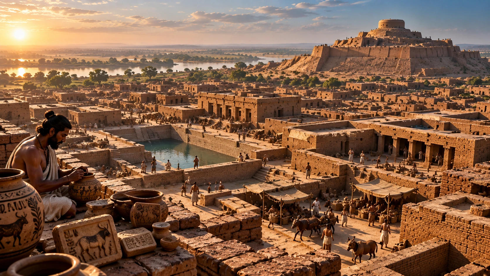
The hero accompanying this article is an artistic reconstruction. Its people, monumental mound and apparent inscriptions are imaginative elements, not verified depictions of a particular Indus city. For other evidence-led histories, explore Morocco’s changing dynasties and Brunei’s maritime sultanate. The Indus deserves the same care: neither a fantasy of lost perfection nor a civilization reduced to its unanswered script.
FAQ
Frequently Asked Questions
When did the Indus Valley Civilization flourish?
Its mature urban phase is generally dated to about 2600–1900 BCE. Earlier settlement roots and later regional traditions extend beyond those dates.
Has the Indus script been deciphered?
No generally accepted decipherment exists. Short inscriptions, uncertain language and the absence of an accepted bilingual key remain obstacles.
Did the Indus population disappear?
No. Urban contraction was followed by continued settlements, movement and regional transformation, not the disappearance of all the people.
PRESDA Dispatch
Stay Informed. Stay Aware.
A sharp briefing across AI, gaming, sport, business, world affairs, paparazzi, and lifestyle.