Red Sprites: The Mysterious Lightning Above Storms
What are red sprites? Explore the brief electrical discharges above thunderstorms, their altitude, discovery, NASA research and safe observation.
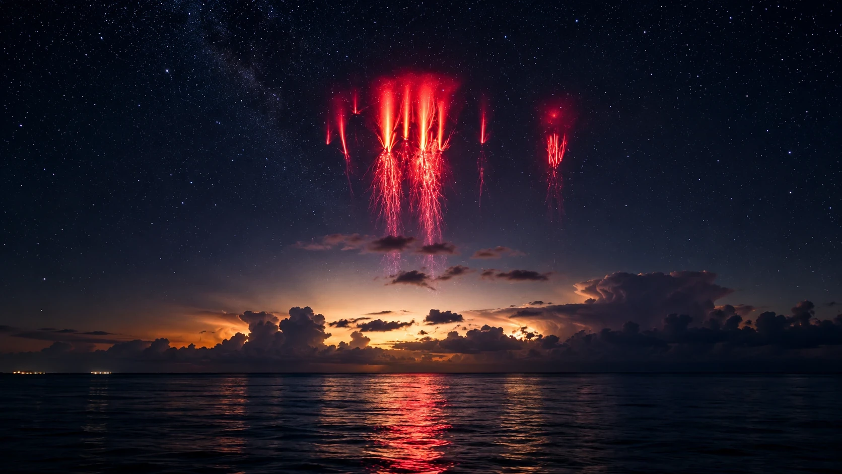
PRESDA AI-generated editorial illustration. A visual interpretation of red sprites, not a photograph of an observed event or a diagram to scale.
A thunderstorm can produce a second light show far above its familiar flashes. For a few milliseconds, red tendrils appear against the darkness, sometimes resembling an inverted tree or a luminous jellyfish. These are sprites: brief electrical discharges in the upper atmosphere, linked to lightning below. They are real, measurable events, even if their appearance makes them seem more like an astronomical apparition than weather.
What are red sprites?
Sprites belong to a family called transient luminous events, or TLEs. Unlike ordinary lightning, their most distinctive light appears high above the storm cloud. NOAA distinguishes them from blue jets and expanding rings known as ELVES. A photograph of a red sprite therefore does not show a conventional lightning bolt simply continuing upward into space. NOAA: lightning types
The difference matters because an image compresses a complicated vertical landscape into one frame. A cloud, the discharge above it and the distant observer may be separated by substantial distances. Their apparent alignment can conceal that geometry. The approved illustration accompanying this article is a visual interpretation, not a measurement of a particular storm or an authentic observation.
How high do sprites occur?
NASA-hosted research places typical sprite emissions roughly 50 to 90 kilometres above Earth's surface, with durations of several milliseconds. Much of this activity occurs in the mesosphere. The red light is associated with excited atmospheric nitrogen; some lower structures can appear blue. Altitude and colour describe an atmospheric process, not a flame burning above the clouds. NASA technical research on sprites and jets
How a storm can illuminate the upper atmosphere
Lightning rapidly redistributes electrical charge. Under suitable conditions, the resulting change in the electric field above a thunderstorm can accelerate electrons enough to excite and ionize the thin air. Light is emitted as excited molecules lose energy. This is why a sprite can be connected to a lightning flash without being the same continuous channel.
NOAA associates sprites especially with powerful positive cloud-to-ground lightning. That association is not a rule that every such flash must produce a sprite. The timing, charge movement and atmospheric conditions have to be considered together. Counting lightning strikes alone cannot tell a photographer exactly when the next red structure will appear.
Why do they look like jellyfish or carrots?
Diffuse upper regions and fine, brighter channels can combine into very different shapes. Camera sensitivity, exposure and viewing distance also influence what an observer sees. NASA's discussion of a photographed sprite over France describes both diffuse tops and bright tendrils, while emphasizing that questions about their formation remain open. A memorable nickname is useful, but it is not a complete physical explanation. NASA: sprites over Château de Beynac
A phenomenon that cameras helped science recognize
Reports of unusual flashes above storms long preceded the modern research field. A turning point came in 1989, when University of Minnesota researchers testing a low-light television camera accidentally captured convincing visual evidence. The recording did not mark the birth of sprites. It gave scientists evidence they could examine, compare and try to reproduce with further observations. NASA: the origins of Spritacular
The story illustrates a recurring pattern in discovery: an event may be visible yet difficult to investigate until instruments make its fleeting details accessible. A single remarkable image raises questions. Repeated observations, reliable timing and measurements from different instruments make those questions testable. The gap between those two stages explains why spectacular photographs still matter to researchers.
Studying sprites from the ground and from orbit
Earth-based observers see storms across the horizon, while instruments in orbit offer a different perspective. The European Space Agency's Atmosphere-Space Interactions Monitor, ASIM, launched in April 2018 and was installed on the International Space Station's Columbus module. It combines optical instruments with detectors for higher-energy radiation to investigate the atmosphere above thunderstorms. ESA: ASIM's journey to space
That wider instrument suite should not be read as proof that every sprite produces every type of emission. Sprites, other luminous events and terrestrial gamma-ray flashes are related research subjects with distinct characteristics. NASA describes the space-station work as a way to improve understanding of storms and their interactions with the atmosphere. NASA: studying storms from the space station
What can amateur observers contribute?
NASA's Spritacular citizen-science project, launched in 2022, invites observations of these elusive events. Useful contributions depend on more than visual drama: where and when an image was made are essential to connecting it with a storm. Keeping the original file and recording the observation conditions makes an image more useful than a heavily edited, context-free social-media post. NASA: Spritacular
Seeing sprites without chasing danger
Sprites are faint and brief. Darkness, a clear view above a distant storm and suitable camera equipment can improve the chance of recording them, but no destination or evening guarantees a sighting. A storm hidden behind low clouds may be electrically active while offering no usable view. The absence of a visible sprite says little about the storm's overall intensity.
Observation should never require standing in an exposed position near lightning. Use a safe location and follow local weather warnings; a photograph is not worth approaching a hazardous storm. For a broader guide to planning observations under dark skies, read PRESDA's dark-sky tourism feature. Stargazing and sprite photography share a need for darkness, but their weather requirements are different.
What sprites reveal about Earth
The fascination is not simply that the sky sometimes glows red. Sprites show that thunderstorms interact with atmospheric regions far above the clouds we watch from the ground. They also expose the limits of everyday perception: an event can be large in scale and still escape notice because it is dim, distant and extraordinarily brief.
The most useful answer to their mystery is therefore neither supernatural nor dismissive. Scientists understand important parts of the electrical mechanism, while continuing to investigate the conditions and structures of individual events. Better cameras, coordinated observations and instruments above the atmosphere are turning a fleeting spectacle into a more detailed account of how our planet works.
FAQ
Frequently Asked Questions
What is this PRESDA article about?
What are red sprites? Explore the brief electrical discharges above thunderstorms, their altitude, discovery, NASA research and safe observation.
Which category does this story belong to?
This story is part of PRESDA's Science coverage.
Who published this article?
Red Sprites: The Mysterious Lightning Above Storms was published by PRESDA Editorial on PRESDA.
PRESDA Dispatch
Stay Informed. Stay Aware.
A sharp briefing across AI, gaming, sport, business, world affairs, paparazzi, and lifestyle.