Tartaria: The Lost Empire That Never Existed?
What did Tartary mean? Explore authentic maps, Tatar history, Mongol khanates and architecture, and examine unsupported Tartaria and Mud Flood claims.
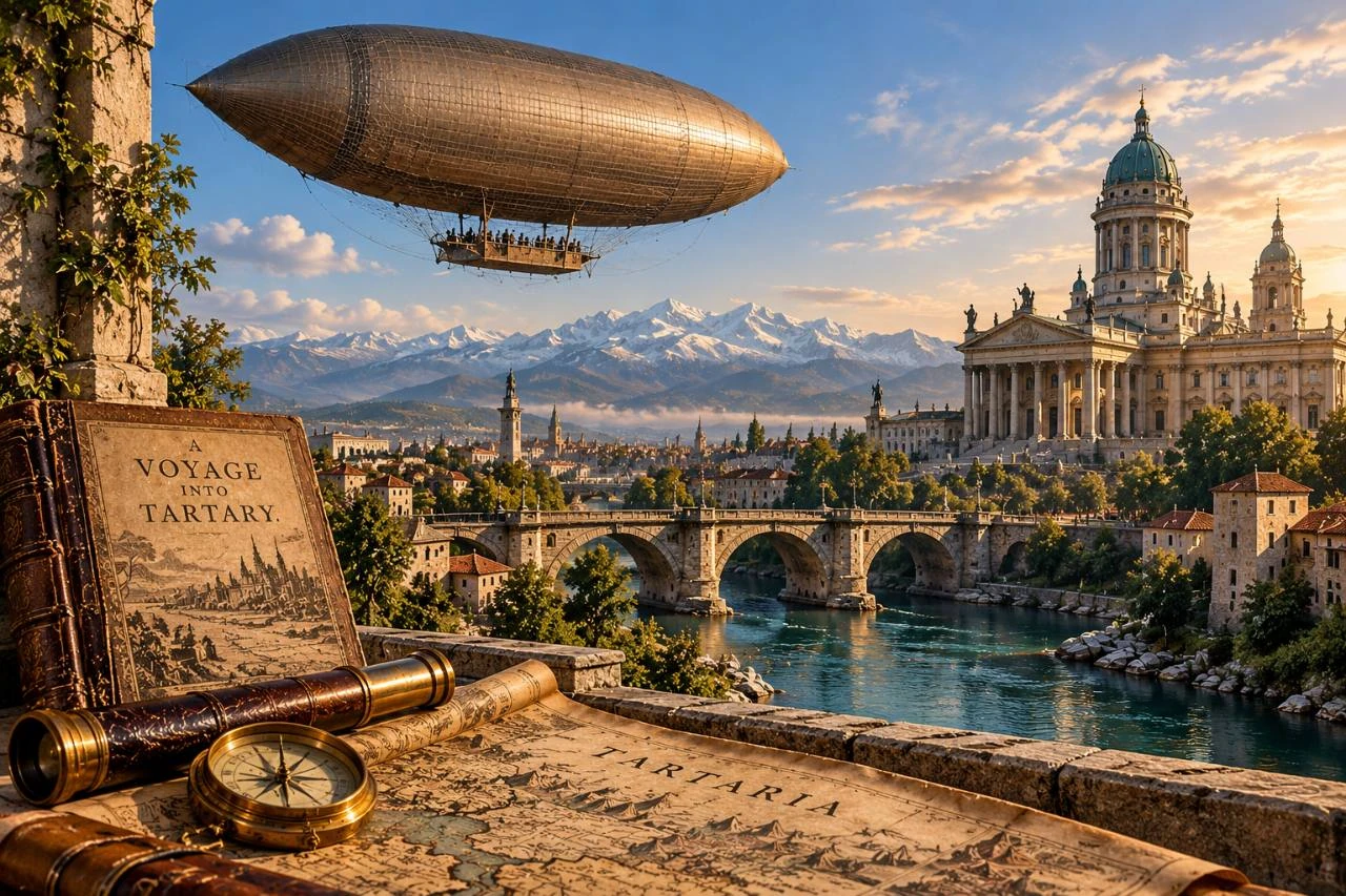
PRESDA AI-generated symbolic illustration: an imagined city, airship and map. Not an archival photograph, a real location or evidence of a Tartarian empire.
The word is real. Across old maps of Asia, Tartary or Tartaria stretches over immense territories, sometimes beneath an ornate cartouche or beside a ruler seated in a tent. Encountering it for the first time can feel like discovering a missing chapter of world history. The question is what that chapter actually contains.
Historical Tartary existed as a geographical label. Tatar peoples, Mongol empires and Turkic khanates were and are real subjects of history. What the evidence does not establish is the modern story of a technologically superior worldwide Tartarian empire, recently erased by a catastrophic mud flood and a coordinated cover-up. Confusing those two propositions turns genuine historical unfamiliarity into a false conclusion.
What did Tartary mean on a map?
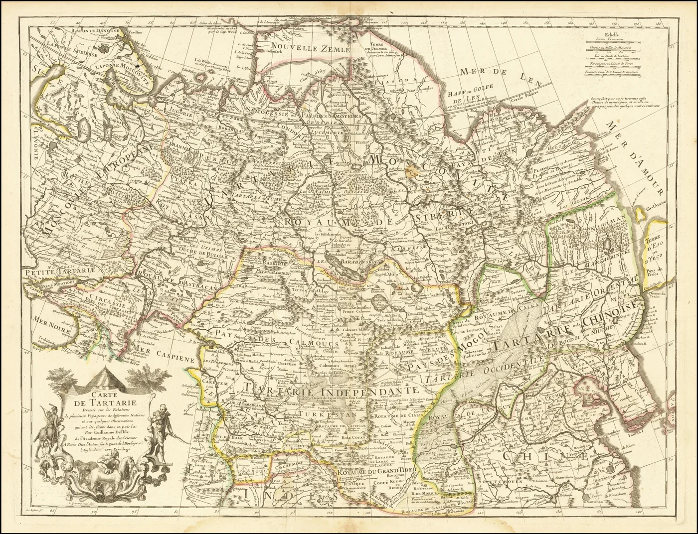
Guillaume Delisle’s Carte de Tartarie, 1706. A genuine historical map whose geographical labels require interpretation.
Guillaume de L'Isle. Source and rights. Public domain.
Resized and converted to WebP; no cropping or content changes.
European cartographers used Tartary for large, inconsistently defined parts of northern and central Asia. The label did not maintain one boundary or political meaning across the centuries. Qualifiers such as Chinese, Independent or Muscovite Tartary could distinguish regions rather than subdivisions of a single sovereign empire. The Library of Congress traces these changing usages through its map collections. A name printed across a vast area is evidence of geographical vocabulary, not by itself evidence of one government. Library of Congress map history
Guillaume Delisle’s Carte de Tartarie, published in 1706, offers an authentic object to examine instead of a cropped social-media screenshot. Its title, place names, scale and publication history belong together. Ask who made the map, which information was available and what the labels signify. Maps compress knowledge, political assumptions and uncertainty onto a surface. Their age makes them historical evidence; it does not make every geographical claim on them infallible. Library of Congress catalog
Tatars are people, not a vanished fantasy
Tatar is not a synonym for an imaginary civilization. It refers to real peoples with distinct histories, including communities associated with the Volga-Ural region, Crimea and Siberia. Their languages, identities and political experiences should not be flattened into a single timeless population. European writers also used related names broadly for peoples they understood imperfectly. The historical category on a foreign map and the identities of the people living there are not interchangeable. Library of Congress
Rejecting a fabricated global empire must therefore not erase genuine Tatar history. A responsible account distinguishes outsiders’ terminology from local names and examines communities through their own records as well as external sources. The attraction of a mysterious label can obscure living cultures. The more productive question is not why historians refuse to discuss a secret people, but which different peoples a particular mapmaker grouped under one word.
The real empires and khanates
The Mongol conquests created an extraordinary transcontinental political system in the thirteenth century. Its history includes warfare and destruction, but also administration, movement of craftspeople and exchanges across Eurasia. The Yuan realm, Chagatai khanate, Golden Horde and Ilkhanate were distinct components of that history. Their rulers, material culture and connections can be studied through evidence. Later Turkic and Tatar khanates should likewise be examined individually, rather than folded into a supposed uninterrupted global state. Metropolitan Museum of Art
The difference is methodological. A documented state leaves interacting traces: coins, inscriptions, diplomatic correspondence, chronicles, administrative practices and archaeological sites. Researchers compare those traces and argue about their interpretation. A claim that every grand building on several continents belonged to one lost empire must meet a comparable standard. Similar-looking domes or the repetition of a map label cannot substitute for the records connecting a particular ruler, institution, place and period.
Why the label disappeared
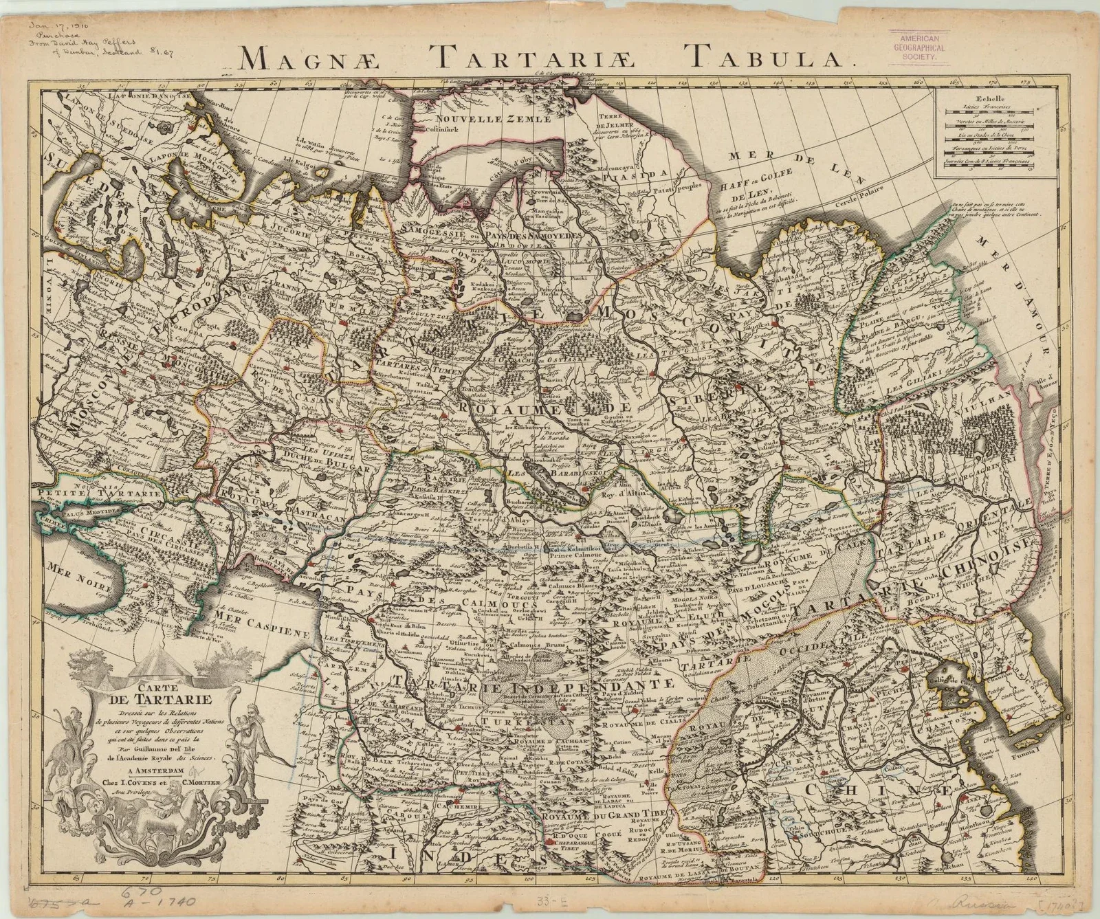
Map of Great Tartary, 1757 edition after Guillaume Delisle, from the University of Wisconsin-Milwaukee Libraries.
Guillaume Delisle, 1757 edition. University of Wisconsin-Milwaukee Libraries, World Digital Library / Library of Congress. Source and rights. Public domain; no known restrictions.
Resized and converted to WebP; no cropping or content changes.
The disappearance of a geographical term is not automatically the disappearance of the territory or its people. Names change as knowledge, conventions and political boundaries change. Old maps retain labels that later maps replace with more specific regional or imperial designations. An atlas is a dated way of organizing the world, not a permanent list of all civilizations that ever existed.
This is why comparing complete maps from different dates is more useful than treating one as a forbidden revelation. The explanatory burden falls on the proposed event. If a modern empire was systematically erased, evidence should show more than a word going out of use. It should establish the institutions that existed, when their destruction occurred and how the independent records of neighboring societies fit that chronology. A missing familiar name does not do that work.
Architecture is not an imperial fingerprint
Domes, columns, arches and elaborate façades traveled through building traditions, education, patronage and imitation. Their presence in distant cities can raise worthwhile questions about exchange. It does not establish that all those buildings were made by a single unknown civilization. Each structure has a history to investigate: site ownership, architects, materials, construction phases, alterations and the purposes for which it was used.
Central Asia offers a richer reality than the conspiracy’s generic monumental world. UNESCO describes Samarkand as a crossroads of cultures with major development during the Timurid period in the fourteenth and fifteenth centuries. Its monuments belong to specific political and artistic histories. Calling them evidence of an undefined Tartarian technology replaces identifiable achievements with speculation. Respect for the past includes giving builders and patrons the identities the evidence supports. UNESCO: Samarkand
The modern Tartaria story
Online Tartaria narratives commonly combine authentic maps, monumental architecture, old photographs and claims of suppressed knowledge. Some versions propose a global empire; others emphasize a recent civilizational reset or buildings supposedly inherited by people unable to construct them. There is no single consistently defined theory. That flexibility allows an unanswered question about one photograph to be treated as support for a much larger claim. Fact-checking overview
The distinction between a question and an explanation matters. It is reasonable to ask how a building was constructed or why its lower windows sit below a pavement. Saying that an erased civilization built it is a proposed answer, requiring additional evidence. A photograph does not become proof of that answer merely because a viewer lacks local historical knowledge. Uncertainty creates a research task; it does not identify the cause in advance.
Mud Flood claims and the ground beneath cities
The Mud Flood story interprets partly buried façades and basement windows as traces of a recent worldwide catastrophe. Local floods, rebuilding, soil accumulation and changes in street levels are real processes, but they must be investigated at the location concerned. A global event would need a coherent chronology and comparable physical evidence across sites, not just a collection of photographs taken at different times and places.
Chicago provides a documented example of altered street levels. In the late 1850s, streets were raised to improve drainage and accommodate sewers, with many buildings raised by their owners. The Encyclopedia of Chicago describes two phases and substantial differences in elevation. That history explains particular urban features without invoking a planetary mud deposit. It does not explain every basement in the world; its value is demonstrating how local records can test an apparently mysterious image. Encyclopedia of Chicago
World’s fairs were constructed, not discovered
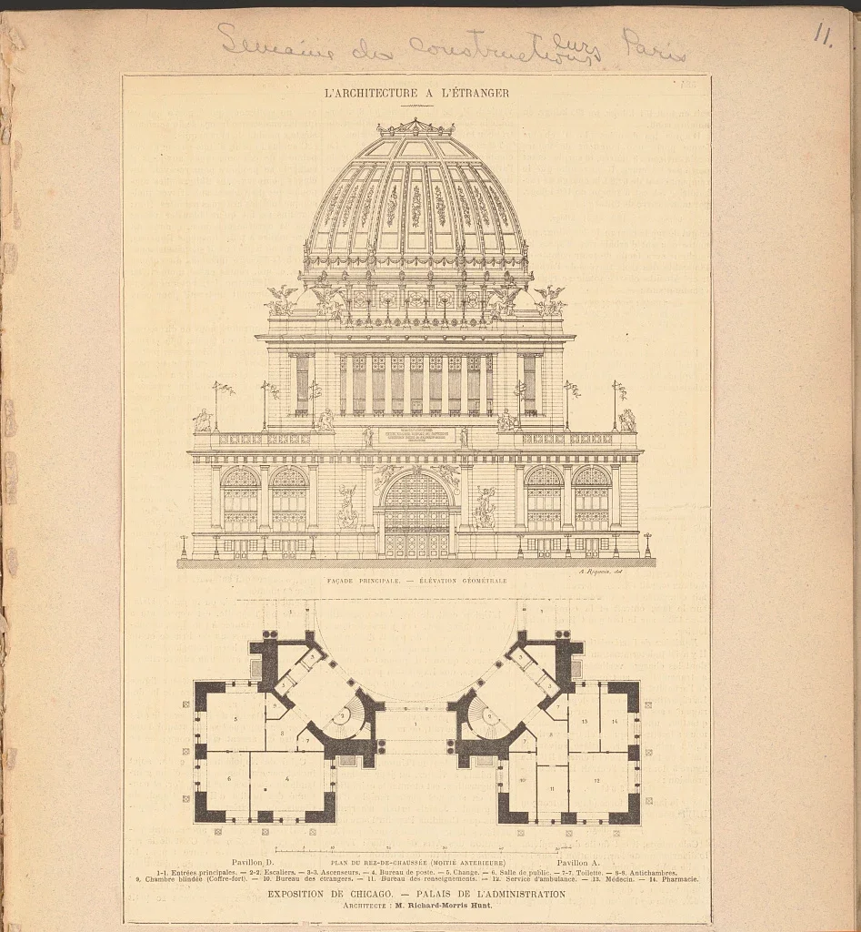
Elevation and plan of Chicago’s 1893 exposition Administration Building: Richard Morris Hunt, architect; A. Riquois, drawing.
Richard Morris Hunt (architect), A. Riquois (drawing), 1893. Library of Congress, Prints and Photographs Division, LC-DIG-ppmsca-73183. Source and rights. Public domain; no known restrictions.
Resized and converted to WebP; no cropping or content changes.
Photographs of spectacular exhibition buildings can look implausible when detached from their purpose. A temporary fair was designed to impress. Its monumental appearance alone does not establish the age, materials or permanence of the structure. Those questions require plans, construction documentation and contemporary accounts, just as they do for an ordinary railway station or theatre.
The Library of Congress preserves an elevation and plan for the Administration Building at Chicago’s 1893 World’s Columbian Exposition, cataloged as a design for a temporary exhibition structure. Such documents are positive evidence of design and construction, rather than merely an absence of evidence for a lost empire. To displace them, an alternative account must explain their provenance and relationship to the actual building. A dramatic façade cannot be assessed independently of the archive that records its making. Library of Congress architectural record
Airships, electricity and alleged lost technology
Airships and ambitious electrical experiments genuinely existed. Their unfamiliarity to a modern viewer does not make them remnants of an erased technological age. The Smithsonian documents the development of lighter-than-air flight and the different engineering approaches used by airship builders. The history involves lifting gases, engines, structures, experiments and failures that can be investigated. National Air and Space Museum
Claims that ornamental towers harvested limitless free energy require a different level of proof: a working mechanism, identifiable components, measurements and reproducible performance. Visual resemblance to an antenna is insufficient. Nor does the existence of a real inventor validate every later claim attached to that inventor’s name. Our account of Nikola Tesla separates documented electrical achievements from the mythology that can accumulate around them. Technological history becomes more interesting when its actual difficulties remain visible.
What would convincing evidence look like?
Start with a claim small enough to test. Identify the building, map or artifact precisely. Locate the earliest accessible version rather than a reposted crop. Read its catalog description and compare independent records. A construction photograph should be checked against plans and dated reports; a supposed flood deposit against geological and archaeological work. Agreement between genuinely independent evidence is stronger than the same unsupported caption repeated on many websites.
The same discipline applies to the claim of suppression. Archives contain gaps, and institutions can make mistakes. Neither fact establishes a coordinated global cover-up. A theory that treats every supporting document as true and every contradicting document as forged cannot be tested fairly. Explaining what evidence would change the conclusion is part of historical reasoning, not a concession to an opponent. Our examination of Moon-landing conspiracy claims uses the same distinction between questions, evidence and unsupported explanations.
The appeal of a missing civilization
The Tartaria story offers an emotionally satisfying arrangement: lost grandeur, hidden knowledge and a discovery that seems available to anyone willing to look closely. The evidence should still be judged claim by claim. It is possible to enjoy old maps, regret demolished buildings and distrust a particular historical account without accepting a global empire or a worldwide mud catastrophe.
Wonder does not require an invented explanation. The real history contains extraordinary mobility across Eurasia, complex multilingual societies, monumental architecture and difficult feats of engineering. It also contains conquest, dispossession and the destruction of cultural heritage. Those histories are not less important because they resist a single secret narrative. Their complexity is precisely what makes them worth investigating.
The answer beneath the title
Tartary was a real historical geographical term. Tatar peoples and the empires and khanates of Eurasia were real. The proposed worldwide advanced Tartarian empire, erased in a recent Mud Flood, is not supported by the evidence examined here. These statements belong together: rejecting the conspiracy does not require denying the people, maps or monuments that it borrows.
An old map is an invitation to investigation, not a shortcut around it. Follow the names back to their sources, the buildings back to their plans and the claims back to the evidence they would require. What emerges may be less tidy than a lost empire. It is also a more substantial world, populated by identifiable people whose achievements do not need a fictional civilization to explain them.
FAQ
Frequently Asked Questions
What is this PRESDA article about?
What did Tartary mean? Explore authentic maps, Tatar history, Mongol khanates and architecture, and examine unsupported Tartaria and Mud Flood claims.
Which category does this story belong to?
This story is part of PRESDA's World coverage.
Who published this article?
Tartaria: The Lost Empire That Never Existed? was published by PRESDA Editorial on PRESDA.
PRESDA Dispatch
Stay Informed. Stay Aware.
A sharp briefing across AI, gaming, sport, business, world affairs, paparazzi, and lifestyle.